ACC News Brief
Extreme Weather Atacama Desert, northern Chile
Satellite-observed weather event - not a climate attribution finding
Rare snow stretched across Chile's Atacama Desert
What happened
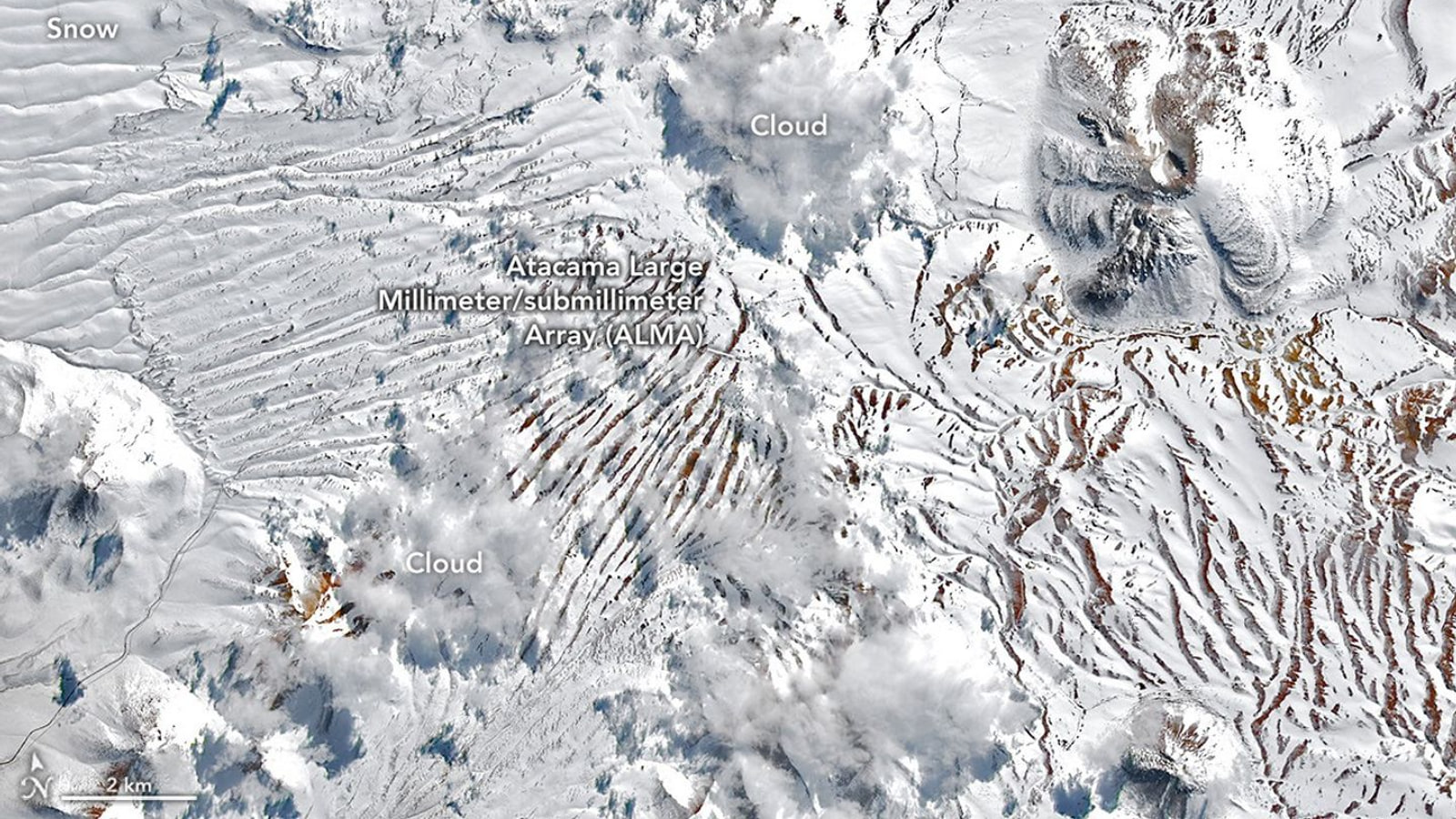
NASA satellite imagery documented back-to-back August winter storms that spread snow from the Andes across the hyper-arid Atacama and close to the Pacific coast. NASA described one event as unusually widespread. The late-August storm involved a cutoff low that separated from an unusually large atmospheric trough, while coastal moisture helped precipitation reach a broad area rarely affected at that scale.
ACC context
NASA explained the atmospheric setup and documented the snow's extent, but the page did not attribute this individual event to climate change. ACC is using the observation to explain rare weather and infrastructure exposure without turning it into a trend claim.
Why it matters
Rare precipitation can disrupt observatories, roads, power, and communities in places built around extreme dryness. The event is also a useful reminder that unusual cold-season snow is weather, not evidence against long-term global warming; understanding it requires atmospheric circulation, moisture, elevation, and local observations.
What to watch
- Final precipitation and snowfall analyses from Chilean meteorological agencies and research institutions.
- Operational impacts at astronomical observatories and in nearby communities.
- Long-term studies of cutoff lows and precipitation variability in northern Chile rather than conclusions from one event.
Sources & evidence
- Rare, Widespread Snow in the Atacama DesertNASA Earth Observatory Image of the Day published August 27, 2026, using NASA-USGS Landsat and NASA Terra observations.
Continue learning with ACC
See how climate trends and individual weather events fit together